At some point after your first climb, the road takes over and your group falls silent. Your tires hiss over loose stone, freehubs click as everyone catches their breath, and the road twists out of sight between the trees before another lake appears through a break in the forest. For a while, you stop checking the distance and forget about the drive home.
That feeling comes easily in Frontenac County. Within a few hours’ drive from Toronto, Ottawa or Montréal, this corner of Eastern Ontario is threaded with rail trails, old roads, rolling gravel and rougher forest tracks that branch in every direction. Some stretches make you feel fast; others make you work for every metre. Along the way, the landscape keeps shifting between lakes, exposed Canadian Shield and quiet roads where you may ride for an hour without meeting a car.
Bring a few friends, load the bikes and leave enough room for an unexpected swim, a longer lunch or a road that takes more effort than it looked like on the map. Head to Sharbot Lake, an ideal base for a first gravel getaway.


Friday Evening: Where Every Good Ride Begins
By the time you lift the bikes off the rack, the pace has already changed. Sharbot Lake sits alongside the K&P Trail, with water visible on both sides of the village. This is cottage country, so things slow down in September as summer winds down. Plan ahead and check for changing hours or menus as the summer pace eases into autumn.
You might settle into Rockhill Bed & Breakfast, Lehlewa Lakeside Retreat, A Cottage by Windrush or one of the many nearby lakeside rentals. Then pull up tomorrow’s route over a drink at Kick & Push Brewing Company while the group quietly redefines what everyone meant by an “easy first day.”

Day One: Following the Roads Less Travelled
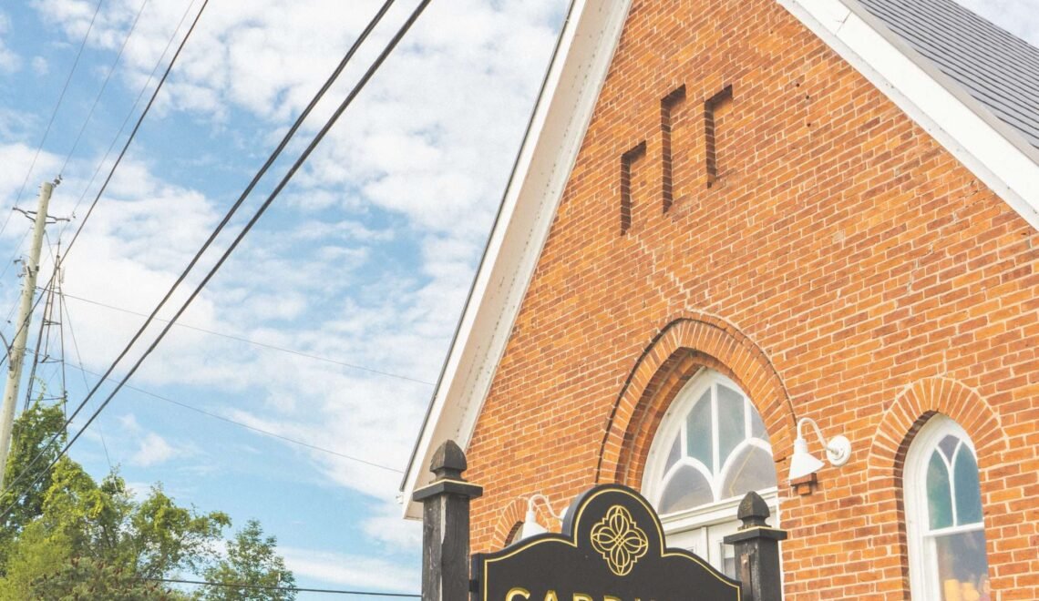
Your first morning begins at Cardinal Cafe, a former church in the centre of the village where you can settle in over coffee and something baked. There is usually one last adjustment before you leave, whether it is a slipping saddlebag, a loose bottle cage or a tire that somehow lost pressure overnight, but soon enough you are rolling onto the K&P Trail.
The opening kilometres of the Frontenac Folly are forgiving and give everyone time to find a comfortable pace. When the route turns onto Bell Line Road, the landscape begins to rise and fall through farm country, forest and exposed rock, and the easy rhythm of the rail trail gives way to the punchy little rollers Jonas still talks about. (See below.)
The Frontenac Folly strings together smooth rail trail, rolling backroads and rougher unmaintained sections, so the ride never settles into a single rhythm. Your ride group may stretch out on the climbs, come back together at intersections and gradually stop noticing how long it has been since a car passed.
Near Big Clear Lake, the water appears beside the road, and the village of Arden arrives around the halfway point. If the hours line up, the general store or a seasonal food stop gives you a reason to linger. A nearby public beach may be even harder to pass, especially on a warm day when taking off your shoes and putting your feet in the water feels more important than keeping to a schedule.
Frontenac Road changes the pace again. Built as an early colonization route, it twists through the Shield for approximately 18km, with tight bends, quick descents and short climbs that keep asking for another gear change and a little more effort. Conversation becomes less frequent, but the road itself gives the group plenty to talk about later.
The lower-lying section of Swamp Road can change after wet weather, so it is worth checking recent route comments before you leave and being prepared to adapt. A gravel ride should have some uncertainty, but ideally not the kind that leaves you stranded.
When the final kilometres return you to the smoother K&P Trail, shoulders begin to relax and conversation picks up again. Back in Sharbot Lake, you can let the bikes wait while you find the water, order a meal and give everyone time to tell a slightly different version of the day.

Day Two: The Dammed Lakes
Bobs Lake was reshaped in the 1870s when the Bolingbroke Dam was enlarged to create a reservoir for the Rideau Canal system, joining several smaller lakes into one sprawling waterscape. Together with neighbouring Crow Lake, these “Dammed Lakes” now shape the winding roads and constantly changing views that define this ride. You can begin at Meisel Woods Conservation Area near Crow Lake and tackle the 76km What About Bobs Lake loop or leave from Sharbot Lake and use the approximately 12km K&P Trail connection to turn it into roughly a 100km day.
The trail eases you into the ride, although your legs may still question yesterday’s decision to make this the longer option. Around Bobs Lake, the character soon becomes rougher and less predictable as gravel roads, quiet pavement, single-lane tracks and unmaintained doubletrack trade places. The trees close in, cottage roads become rough cart tracks, and a section that lets you move quickly can be followed almost immediately by one that asks you to slow down and choose a line.
By now, everyone has found their rhythm. You wait only at the important intersections, someone still has the last good snack hidden in a frame bag, and the rough sections are balanced by long quiet roads with broad views across the lakes.
There are no dependable food stops on this main loop, so what you carry is what you eat. Pick up a few buggy whips from Seed to Sausage before leaving; by the time you return to Sharbot Lake you will be glad you did. By the end of the day, the bikes are dusty and you have probably found at least one muscle that was not noticeable on Friday. Over dinner, the group will reminisce over the roughest hills, share photos of the best lake views and revisit the debate over whether that shortcut had ever really been a good idea.
The weekend is not really about collecting kilometres. It is about heading out together, finding roads you did not know were there and returning with a shared story of adventure.
The lower-lying section of Swamp Road can change after wet weather, so it is worth checking recent route comments before you leave and being prepared to adapt. A gravel ride should have some uncertainty, but ideally not the kind that leaves you stranded.
When the final kilometres return you to the smoother K&P Trail, shoulders begin to relax and conversation picks up again. Back in Sharbot Lake, you can let the bikes wait while you find the water, order a meal and give everyone time to tell a slightly different version of the day.

Ready for More? Take on the Full Frontenac
If the weekend leaves you studying the map again, the Full Frontenac offers a reason to return.
The route brings together nearly 200km of rail trail, gravel roads, lakeside riding and rugged doubletrack in one long tour of the region. Approximately 85% is gravel, and while a strong rider can complete it in a very long day, the route is better understaken as a two-day dirt tour.
The route links Bobs Lake, Crow Lake, Sharbot Lake, Frontenac Road and the country south of Frontenac Provincial Park. Sustained climbs, rough roads and technical sections reward patience as much as fitness.
While the established route begins near Frontenac Provincial Park, Sharbot Lake offers another natural place to begin, refuel or take a longer pause. Beyond the village, the route reaches into quieter country where services become less frequent and you rely more heavily on your bike, your supplies and the people riding beside you. Maybe you’ll decide to ride all 200km in a single push. Or maybe you’ll carry what you need for two days and disappear into the backroads. Either way, it’s the kind of route that has a way of lingering in your thoughts long after you get home.
Find Your Way to Frontenac
After a weekend here, you will probably understand exactly what local rider (and music producer) Jonas Bonnetta means when he says:
“The Sharbot Lake area has the most perfect twisty roads branching off in every direction. I’m talking sweet, punchy little rolling hills that make you feel fast. It’s easy to ride for an hour and not meet a car, and with ample swimming spots and a growing trail network it one of the best hidden gravel destinations in Ontario.”
Find Out More & Plan Your Visit
- Explore Frontenac County – Visitor information and cycling routes to plan your trip
- Frontenac County Online and Interactive Map – Interactive maps, select transportation layers
- RideGravel.ca – web resource for gravel and bikepacking routes in central and eastern, including a number in Frontenac County
- Ontario Bike Trails – Find a useful map for rail trails across Ontario, including recent reviews, trail descriptions and photos
- Frontenac County – Great Places to Cycle – Ontario By Bike – Find more cycling routes and ride ideas, plus bicycle friendly places to eat, visit, and sleep
—–
Sponsored Content Partner: County of Frontenac
Photo Credits: 1,2 – Jeff Gee; 2, 3, 7 – Jonas Bonnetta; 4, 5, 6 – Untold Storytelling

The post Find Your Way: A Gravel Getaway in Frontenac appeared first on Ontario By Bike.